Photo Friday: Tuck and Robin Lakes + Dip Top Gap
This is a three-night backpack trip I did with my brother-in-law back in September, in Washington State's Alpine Lakes Wilderness. I had meant to do an additional two nights but that was when the Bolt Creek fire blew up and closed US 2 over the mountains--where I had intended to come out. I of course didn't know that at the time, but the sudden increase in smoke where we were and still more to the north where I wanted to go meant retreat was the right option.
Day 1: Tuck and Robin Lakes
 |
| The payoff at Tuck Lake. There is limited camping here, but it can be done if you don't want to carry a full pack all the way up. |
If we thought the trail to Tuck Lake was steep and challenging, that was because we hadn't yet seen the "trail" to Robin Lakes. It's actually kind of amazing that we could lose that track so often, because I'll bet there are at least 20 people at that lake every night (we were there on a Tuesday and were aware of at least 5 other parties), so they have tramped out a pretty good trail (of course, many of those other people also wandered around a fair bit, creating the false leads we followed too often). That last 3/4 of a mile (and 1000') from Tuck to Robin Lakes took us nearly 2 hours of route-finding and wheezing our way uphill very slowly.
 | |||
| One of the easy bits. Scenic rewards all along the way were high, with views of Mt. Daniel most of the way. |
 |
| We eventually found our camp in the trees on the isthmus, just before it gets steep. |
The rewards were totally worth the price of admission. It felt like I was back in the Sierra, with lots of granite and some big peaks to admire.
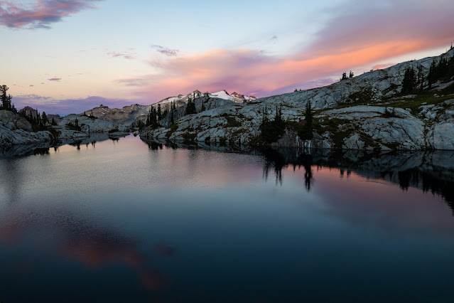
It's hard to narrow down the photos, as the changing light constantly changed the view out over lower Robin Lake. As the sun set, we captured some magical moments.
Lower Robin Lake and Mt. Daniel. If you look closely on the left skyline you can see Rainier.
We were aware even then that there were fires burning in several places in the Washington Cascades, casting a yellow-orange haze over the evening light.
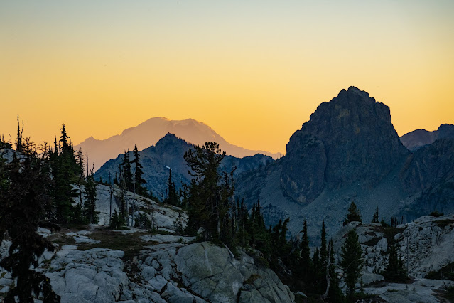 |
| Mt. Rainier. |
It's hard to know where to stop with these photos.
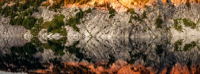 |
| Upper Robin Lake abstract. |
Day 2: From Robin Lakes to Marmot Lake
The evening was nice. The morning brought the real money shot, the sunrise moment we'd come for.When the photography ran thin for me (sooner than for my brother-in-law; he's a professional), I took time to harvest some of the mountain blueberries that make up many of my fondest memories of hiking the Cascades 30 years ago.
 |
| The morning oatmeal got a lot better. It already featured cinnamon, walnuts, and dried apples. |
Eventually we finished breakfast and packed up, and braced ourselves for the 2200' descent to the Deception Pass trail so that we could go on to Marmot Lake. We had some thought of continuing above Marmot to Jade lake, but the ageing bodies had something to say about that. Instead, we found a hidden camp at Marmot Lake, avoiding the scene at the main camping area, and settled in for an afternoon nap.
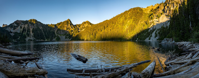 |
| Marmot Lake in the late afternoon light. We need to head up the gully at the very far left of the photo. |
There wasn't a lot of photography on that hike, though there were blueberries to be snagged along the way. It also wasn't a short stroll. We covered 7 miles, over 1440' of climbing and, the real destroyer, 2740' of mostly steep, often very steep, descent. The idea of another mile or so with a climb much like that between Tuck and Robin convinced us we weren't dragging our packs up there.
Day 3: Dip Top Gap
 |
| The initial scramble up a rock-strewn gully looked like prime pika habitat--and they delivered. |
Working hard to beat the heat, we topped out the first climb about 8:40 a.m., with the light still full of early-morning warmth.
 |
| This was a nice area for very-low-bush blueberries, too. We did a bit of a harvest on the way down. |
Washington doesn't have many true glacial-milk lakes. Jade Lake is a striking example, as the unnamed glacier between the lake and Dip Top gap continues to send down the silt that gives the lake its distinctive color.
 |
| Looking straight across the lake at the glacier we need to climb. |
First we had to climb around to the left to get into the gully. That had some fun bits but was mostly trail. ("Fun bits" is of course hiker code for good places to hurt yourself.)
 |
| Looking back across Jade lake. The camps are around the left edge, and are limited due to revegetation the Forest Service is working on. We did well to camp below. |
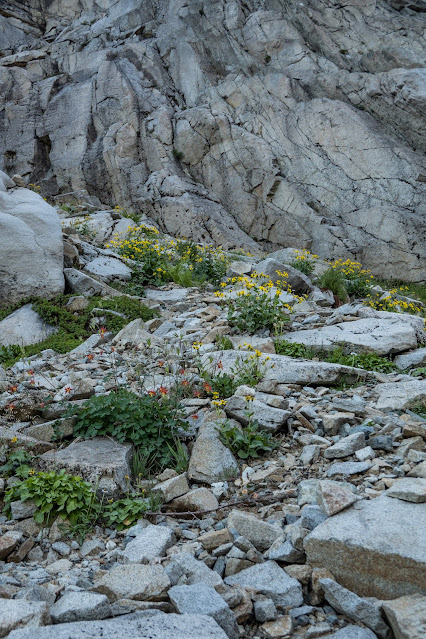 |
| Wildflowers grab their opportunities at these elevations. |
 |
| Looking up the glacier. The steep bit in the middle turned out to be both farther and steeper than it appeared. |
 | |
| I was happy to have the microspikes I bought last year in Nepal. I have now worn them on 3 separate days--got my $15 worth! |
Our early start actually worked against us on the climb--the surface of the glacier was still very icy, making it harder for our short spikes to get a good bite. About halfway up the steep bit we realized it was crazy to be there, and moved to the rocks on the left side of the gully (right in the photo below). I returned to the ice above the steep slope, but Tom's spikes were less effective than mine (lighter, too, on the other hand) and he stuck to the rocks.
 |
| Looking back down from the point where we crawled off into the rocks. |
It was also becoming clear that the smoke was getting thicker to the north. We attributed this to a change in wind direction or similar. (We were wrong.)
Once at the gap, we got the view we'd come for--Pea Soup Lake and Mt. Daniel, up close and personal.
We were in no hurry, and once back down to where there was running water, we stopped to filter and take a little break.
 |
| I can't be asleep. I'm holding the camera. |
Day 4: Fleeing the smoke
The smoky air hurt our eyes and throats, but even so I took a little convincing that this wasn't going to get better with a little change of wind direction. In fact, Tom used his Garmin In-Reach Mini to communicate with his wife, who still had no info on the new fire, but could tell us that the winds would stay the way they were and that smoke levels were beyond unhealthy throughout the Alpine Lakes. Sad but resigned, I hiked out with two spare days of food in my pack.
 |
| Smoke made everything a bit unreal. That bright spot on the left is the sun, dimmed by smoke. |
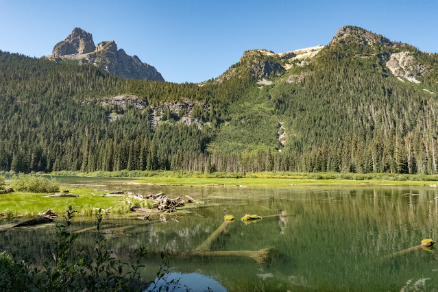
Take a look back at that first photo in this report (I know, that was a very long way back), to see just how bad the smoke was. The photo below is taken at pretty much the same spot.
Here's that first photo again for comparison.
It was a huge relief to reach the car and be able to filter air through the vent system for the drive home to Seattle--where we found the air quality at least as bad, locking us all down in our homes for a couple of days until we finally got rain.
In the end, we weren't sorry not to be hiking from Jade lake. The exit hike was 9 miles, with about 2300' of descending (and a very modest climb in the first third). We knocked it out in a hurry, and I distracted myself from my discomfort by plotting my next murder--murder mystery, that is. With luck, I'll be sharing that book with you by the end of the year!



Why did you have to throw me under the bus like that? Nice report, better pics.
ReplyDeleteLOL. Thought some of those were going to kill me. Of course, I hadn't been carrying a full pack all summer, just bounding along under a daypack.
DeleteSometimes I worry for your safety, but you seem to have a good head on either your or a companion's shoulders :O
ReplyDeleteI'm too scared of exposure (edges) to do anything risky on those lines. Getting used to the reality of fires and what they can do to one's plans is taking longer, but I'm getting there. If I had gone on, I wouldn't have been walking into the fire, but hiking for 3 days in damaging amounts of smoke, and then leaving my daughter to manage a very long drive around the closed roads to pick me up (on roads that were crowded with traffic as there were two passes closed by two different fires that weekend).
Delete